This software inserts and remove the tags exif latitude, longitude and altitude in jpeg, tiff and png images performing the geo-positioning of images, it uses tracklogs of GPS devices.
Features
- Handles tags EXIF / IPTC in images: jpeg, png, tiff, pgf, psd.
- Add latitude, longitude and altitude to images files.
- Remove latitude, longitude and altitude from images files.
- Positioning geographically imagens using tracklogs GPS.
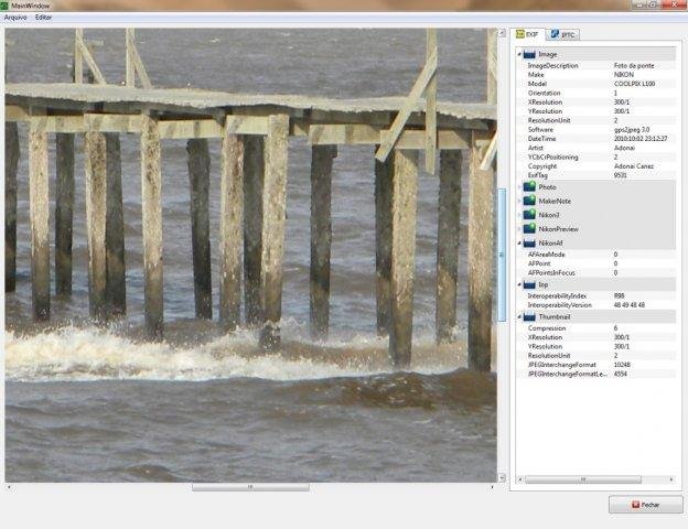
- Show all EXIF, IPTC and XMP informations.
Project Samples

Categories
Metadata EditorsLicense
GNU General Public License version 3.0 (GPLv3)Follow gps2jpeg
Other Useful Business Software
Earn up to 15% annual interest with Nexo.
Put idle assets to work with competitive interest rates, borrow without selling, and trade with precision. All in one platform.
Geographic restrictions, eligibility, and terms apply.
Rate This Project
Login To Rate This Project
User Reviews
Be the first to post a review of gps2jpeg!
